


News
Chinese Scientists Discover Overseas Archaeological Sites for the First Time along the Silk Road by Remote Sensing
Date:2018-06-12
For the first time, Chinese scientises have discovered archaeological sites outside China using the remote sensing technology. These sites unveil the layout of the south-line military defense system and irrigation system in ancient Rome.

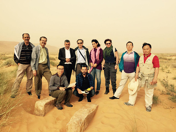
Field verification of the site of an irrigation system

Field verification of the site of an irrigation system
Field verification of the site of a retaining dam
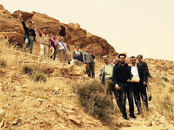
On-the-spot investigation of a cave site from the Neolithic Period

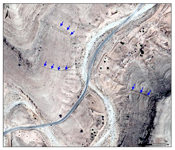
Ten new sites are discovered via remote sensing in southern Tunisia: 1 and 2 are forts; 3,4, and 5 are limes; 6,7, and 8 are cisterns; 9 isan irrigation system; 10 is a cemetery
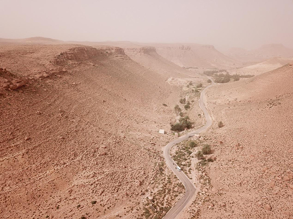
Desert landform of South Central Tunisia
Success is made after two years of image processing and field investigation
This joint archaeological project takes two years.In March 2016,scientists started carrying out indoor processing,interpretation,and analysis of remote sensing images and collaborated with local archaeologists to conduct field survey and verification in April and November 2017 and April 2018 respectively.Finally,they identified ten new archaeological sites of ancient Rome in southern Tunisia,including three sections of limes,two forts,one irrigation system,three tanks,and one tomb.These archeological remains constitute a chain of evidence that reflects the military defense system in the south of the ancient Roman Empire.
Site of the lime
Forts in ancient Rome

Site of the tank

Site of the irrigation system: the diversion dam is shown in blue and the retaining dam in yellow
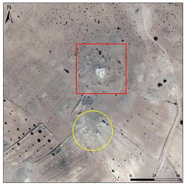
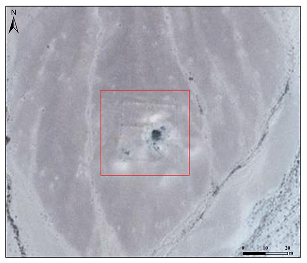
The newly-discovered site of the ancient tomb is indicated by the yellow circle and the known site of forts by the red frame
Specifically, limes and forts are used to defend and protect the border from invasions of nomads from the south and west.The irrigation system and tanks for storage of fresh water are designed for food production tomeet the living needs of soldiers and civilians along the border.
China leads the world in discovering archaeological sitesby means of space technology
In fact,HIST has applied space archaeology technologies to discovering many archaeological remains and conducted extensive cooperation with a lot of countries,reaching the advanced level of the world.
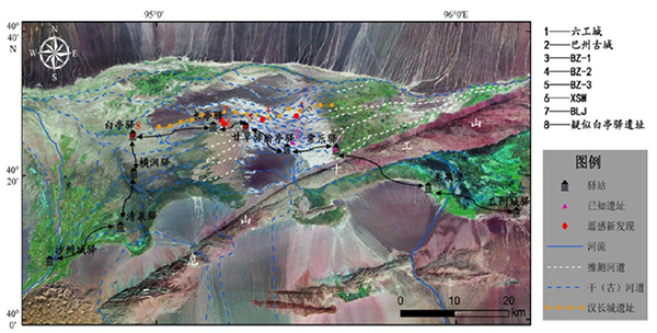
Archaeological discoveries in Guazhou (Anxi)-Shazhou (Dunhuang) section of Gansu province
In 2013,HIST and its hosting Aerospace Information Research Institute (AIR)of the Chinese Academy of Sciences,signed the Memorandum of Understanding with the National Authority for the Protection and Management of Angkor and the Region of Siem Reap(APSARA)to monitor Angkor and its surrounding environment via remote sensing technology,and subsequently to build a“sky-eye”system by using the remote sensing technology,so as to protect Angkor and its surrounding environment in Cambodia.

Classification of land use of the Angkor Site via remote sensing
These discoveries of space archeology in Tunisia are of significance in studying the military defense system and irrigation system in ancient Rome,the west-end route of the Silk Road,changes in ancient oases,and environmental evolution.
In addition, Chinese scientises, for the first time, have led relevant countries in Asia, Europe and Africa to discover foreign archaeological remains and conduct systematic research by comprehensively utlizing the remote sensing observation technologies, satellite navigation system and geographic information analysis system, and based on literature analysis, and technologies and methods for space archaeology employed in the field survey. It is of great milestone significance to improve international cooperation and research conducted by the Chinese scientists along the "Belt and Road" to develop a new model of research techniques and methods in space archaeology.
This press conference was hosted by the DBAR-Heritage Working Group. The working group consists of the members of Aerospace Information Research Institute (AIR)/ the International Centre on Space Technologies for Natural and Cultural Heritage, under the auspices of UNESCO (HIST); Tunisian National Heritage Institute (INP); Tunisian Arid Regions Institute (IRA); Italian National Research Council (CNR); and COMSATA Institute of Information Technology (COMSATS CIIT) in Pakistan.
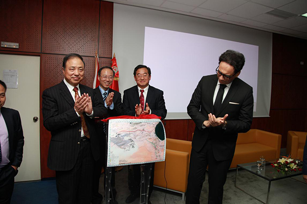
Prof.Guo Huadong,President of DBAR and Director of HIST,unveiled the satellite image of new discoverieswith Mr.Mohamed Zin Alabidin,Tunisian Minister of Culture,at the PressConference.