

News
UNESCO designates 15 new Geoparks in Asia, Europe, and Latin America
Date:2020-07-13
Paris, 10 July—UNESCO’s Executive Boards has approved the designation of 15 new UNESCO Global Geoparks, which brings the number of sites participating in the Global Geoparks Network to 161 in 44 countries. The Executive Board also approved the extension of the Kula-Salihli UNESCO Global Geopark in Turkey.
UNESCO Global Geoparks were designated for the first time in Nicaragua, the Russian Federation and Serbia.
The newly designated Geoparks are:
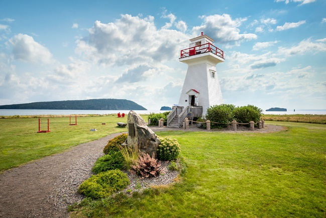
Cliffs of Fundy UNESCO Global Geopark (Canada)
On the North shore of the Minas Basin in Nova Scotia, Canada, the Geopark features a varied landscape of hills, mountains, valleys, heavily forested areas, and coastal marshlands. Its broad biodiversity includes rare birds, fungi and plants. Minas Basin, an inlet in the Bay of Fundy, which is known for having the highest tides on Earth, is part of the Geopark that features exposures of the Central Atlantic Magmatic Province, the largest outpouring of lava in Earth history, fossils of early dinosaurs, vertebrates and more. The indigenous people of the region, The Mi’kmaq, have lived in the area for thousands of years, making it one of the earliest known sites of human habitation in northeastern North America. Passed down through the ages, their stories explain many geosites and the communities of Cliffs of Fundy are committed to preserving them for future generations.
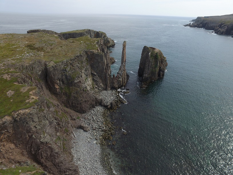
Discovery UNESCO Global Geopark (Canada)
Located in Newfoundland Labrador, in the east of the country, the Geopark covers over 280 km of rugged coastline full of remarkable views on caves, arches and sea stacks. Sites within the boundary of the Geopark bear witness to the region’s geological history which has shaped the land, its human inhabitants and their culture. The area lies entirely with the Avalon terrane of the Appalachian Orogen, which is dominated by a complex assemblage of Neoproterozoic sedimentary, volcanic and plutonic rocks. The coastal geology offers a unique opportunity to observe, study, and celebrate one of the most significant transitions in Earth’s history: the Ediacaran Period, and its associated rise of animal life. With rocks over a half a billion years old, the Geopark is host to some of the most spectacular and exceptionally preserved Ediacaran fossil sites on Earth.
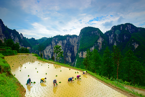
Xiangxi UNESCO Global Geopark (China)
In the hinterland of the Wuling Mountains in Xiangxi Tujia and Miao Autonomous Prefecture (Hunan Province), the Geopark bears witness to a rich human history starting in the Paleolithic age and features 160 cultural sites from the Paleolithic and Neolithic ages. The area is now mainly inhabited by Tujia and Miao ethnic minorities, the earliest indigenous people living in Xiangxi Prefecture, whose rich history and culture have given rise to unique folk customs. The geology of the area records the forming of the Yangtze Platform, a foreland basin that has undergone multiple stages of tectonic evolution. In the Geopark, the Cambrian system is particularly visible, with two sites of high international importance. The area is also known for its Red Stone Forest, the Dehang Grand Canyon, the Zuolong Valley, and many spectacular waterfalls.
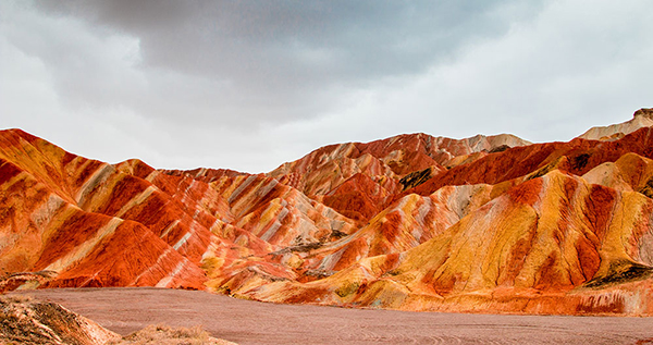
Zhangye UNESCO Global Geopark (China)
The Geopark is located in Zhangye City, Gansu Province, which was an important township on the ancient Silk Road, trade route between China and the West. The Geopark’s 577 cultural sites bear witness to the history of the city that is home to a number of minority ethnic groups, including Yugurs, with distinct cultures and lifestyles. The most notable feature of the Geopark is the presence of colourful hills, the best example of China’s Danxia landform, formed by folded sandstones in different colours. Some of the hills have been eroded creating ‘window-lattice’ and ‘palace-style’ landforms. Another important feature is the ‘Nine-Springs’ ophiolite, a remnant of the ancient oceanic crust, which has been studied by multiple geologists for its international geological significance.
Lauhanvuori-Hämeenkangas UNESCO Global Geopark (Finland)
The Geopark, situated in the west of the country consists of exceptionally well-preserved pristine mire landscapes which are enriched by numerous glacial and bedrock formations. They tell the story of the ancient development of the region from a mountain landscape to one characterized by mires and forests. The history of the area has always been nourished by the many travelers who used the area’s natural passageways. First signs of human habitation in the region have been found at the ‘wolf cave’, one of the most northern locations with Neanderthal remains. The Kyrönkangas road, has been running through the Geopark connecting Finland to the Gulf of Bothnia, since the 16th century CE, bringing newcomers who left their mark on local culture. Many of these old traditions have been preserved, among them the manufacture of Sahti, the only primitive beer to survive in Western Europe.
Toba Caldera UNESCO Global Geopark (Indonesia)
Located on Sumatra Island, Toba Caldera was formed by a super-volcano eruption 74,000 years ago. The water-filled basin of the caldera is the largest volcanic lake in Indonesia and is situated 904 metres above sea level. The large Samosir Island rises up from the lake set amidst wave hills, mountains and plains. The creation of the caldera exposed basement rocks, enabling scientists to study what was once part of the mega continent Gondwana. Home to the Batak Toba, Simalungun, Karo and Pakpak people, the area has a rich cultural heritage which can be explored by visiting traditional houses and museums in the Geopark.
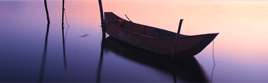
Rio Coco UNESCO Global Geopark (Nicaragua)
Located in the north of Nicaragua, Rio Coco is part of the volcanic Central Mountainous Chain featuring a landscape of rolling hills and plains with small valleys. The elevated and broken topography of the area offers lookout points and panoramic views of a range of ongoing tectonic phenomena, in a landscape of wetlands, highland springs and cloud forests. The territory is home to three emblematic trees: the almond tree of ‘Tere Armijo’, the Branded Guapino tree, and the 500-year-old Golden Ceiba, sacred for the Mayan people. The area has a rich history, marked by Taguzgalpa heritage, with numerous pre-Hispanic settlements and a few examples of cave art. Spanish conquistadors, established the Cuje gold mines in Rio Coco and built the parish church of Santa Maria de Magdalena in Totogalpa (18th and 19th centuries).
Estrela UNESCO Global Geopark (Portugal)
Located in the centre of the country, the Geopark is named after the Serra Estrela mountain range. During the Pleistocene, an ice field developed on top of the plateau, creating the features that endowed the area with its distinctive geological characteristics: glacial deposits such as the Lagoa Seca moraine field, and glacial landforms, such as the Zêzere glacial valley. The Geopark also presents a significant diversity of granite weathering forms such as the Cov vão do Boi granite columns, a large set of natural tor-like granite columns controlled by a dense orthogonal fracture network, together with different large forms including inselberge (isolated hills or mountains rising abruptly from a plane) and smaller, mushroom-shaped formations.
Hantangang UNESCO Global Geopark (Republic of Korea)
Situated in the central part of the Korean Peninsula, the Geopark features a unique volcanic landscape of deep gorges, basalt cliffs, columnar joints and waterfalls formed during the late Quaternary, after the eruption of Ori Mountain, which unleashed a lava flow between parallel mountain ranges along the old Hantangang River Valley, creating the Cheorwon Lava Plateau. Hantangang River subsequently eroded a new path through the lava plateau, developing its unique volcanic topography. The area wealth of cultural and archaeological sites including Jeongok-ri, which dates back to the Stone Age, testifies to its strategic importance for trade and war.
Yangan-Tau UNESCO Global Geopark (Russian Federation)
Located in the Salavat District in the north-east of the Republic of Bashkortostan, the area is known for the rich diversity of it geology, flora and fauna, as well as cultural traditions. Three major geological structures account for the Geopark’s varied landscape: the East European Platform, the Uralian Foredeep and the Ural Mountains. One of the outstanding geological features of the Geopark is the Yangantau Mountain with unique thermal anomalies, creating geothermal springs without the presence of magmatic activity. Other notable features include lowland peat-bogs, karst caves, the Kurganzak spring, Keselyaroyo sulfur springs and the Mechetlino section.
© Yangan-Tau Geopark, Bashkortostan, Russia
Djerdap UNESCO Global Geopark (Serbia)
The area, in the northeast of the country, features very diverse geology, spanning the oldest Proterozoic rocks to the youngest Quaternary sediments. The most striking natural phenomenon in the Geopark is the Djerdap Gorge, the longest in Europe. The gorge was incised by the Danube which also formed the present karst landscape of tunnel caves, karst springs and natural bridges, such as the Vratna natural bridges. Inhabited since the early Mesolithic, the area is home to a rich cultural heritage which includes prehistoric sites (Lepenski Vi and Rudna Glava), Roman remains, medieval fortresses, old traditional houses, churches and a monastery. Villages are nowadays inhabited by Serbs and Vlachs, two groups with different cultures and ways of living, which have created some mixed traditions through the ages.
Granada UNESCO Global Geopark (Spain)
Located in the south-west of the country and surrounded by some of the highest mountains of the Iberian Peninsula, the area contains stone evidence of the geological history of a river and a lake that were active in the Quaternary. It is marked by an extraordinary record of continental Quaternary sediments which eroded and formed valleys. These processes created a unique troglodytic landscape, with a singular type of traditional cave-houses, inhabited since the Middle Ages, which now house restaurants, tourist accommodations, interpretation centres, wine cellars, etc. The area is also known for its many archaeological sites that showcase the region’s rich historical, artistic and cultural heritage.
Maestrazgo UNESCO Global Geopark (Spain)
In the province of Teruel, within the Aragonese western branch of the Iberian Mountain Range, the Geopark’s extensive territory encompasses 43 municipalities with beautiful towns and built heritage set in varied landscapes, home to a rich history and traditional celebrations. The two most notable geological highlights of the Geopark are: The Jurassic-Cretaceous dinosaur sites in Galve where the first dinosaur in Spain was found, and the Mesozoic series in the Maestrazgo area, one of the most representative and complete exposures of the Cretaceous geological history of the Iberian Mountain Range. Other remarkable sites include the Cristal Caves Natural Monument, El Recuenco cave, Cañizar del Olivar (Calcareous tuff building) and multiple dinosaur sites with fossils and footprints.
The Black Country UNESCO Global Geopark (United Kingdom)
The Geopark is a special urban landscape in the heart of England with geology spanning 428 million years that is well known for its exceptionally well-preserved fossils. The Black Country is also rich in coal, ironstone and limestone, resources which inspired discovery, invention and innovation and placed the region at the centre of the Industrial Revolution which continues to shape the modern world. The Geopark boasts a range of varied geosites including landscapes and viewpoints, disused mines and quarries, canals, national and local nature reserves, museums with spectacular collections, open air visitor attractions and many historic buildings. It connects the geology under our feet with cultural and industrial heritage.
Dak Nong UNESCO Global Geopark (Viet Nam)
Located in Dak Nong Province in the Central Highlands, the Geopark’s geological past goes back 200 to 165 million years when the area was part of the ancient Gondwana supercontinent. More recent volcanic activity a few tens of thousands of years ago have endowed it with spectacular craters, majestic waterfalls and Southeast Asia’s most extensive system of hundreds of magnificent volcanic caves. Its geological morphology and varied soil and climatic conditions, are home to a rich range in biodiversity and ecosystems, including many endemic rare species. Dak Nong was originally inhabited by three indigenous peoples, the M’Nong, Ma and Ede. Following an influx of immigrants in the late 1970s it has become the home of over 40 ethnic groups and a place of rich cultural diversity.
Extension of an existing UNESCO Global Geopark:
Kula-Salihli UNESCO Global Geopark (Turkey)
Located in the eastern part of the Aegean Region of Turkey, the Geopark contains evidence from more than 200 million years of earth history, from Paleozoic metamorphic rocks to prehistoric volcanic eruptions. It encompasses three distinct areas: the Kula volcanic province: one of the youngest volcanic fields in Turkey, the Gediz Graben: a very tectonically active region and the Bozdağ Mountains. The Geopark features a large lava plateau, lava caves and basalt columns together with the range of morphological features associated with the formation of a graben, such as faults, fan deposits, earthquake related features, etc. The Geopark is also of great historical significance with Homoerectus Valley, the Çakallar human footprint fossils, the Kanlıkaya rock paintings and the tumulus tombs of what once was the capital of the kingdom of Lydia, where money is believed to have been invented, the ruins of Sardis, founded nearly 3,000 years ago, and of a temple dedicated to Artemis in the 3rd century BCE.