—A Case Study of Remote Sensing Archaeology from Qiemo to Khotan
Project Name: On Shift and Driving Mechanism of the Middle Segment of Southern Silk Road— A Case Study of Remote Sensing Archaeology from Qiemo to Khotan
Project Leader: Wang Xinyuan
Team Members: Wang Xinyuan, Liu Chuansheng, Yang Ruixia , Jing Linhai, Bi Jiantao, Luo Lei, Xiang Bo
Project Entrusted by: Aerospace Information Research Institute, Chinese Academy of Sciences
Project Period: January 1, 2013 – December 31, 2016
Project Overview:
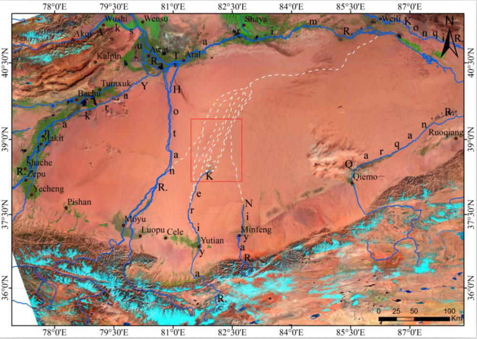
About 200 B.C., several routes of Silk Road had been developed along oasises, towns, and water, as important trade route ways between China and the Middle Asia, Western Asia, and Europe. The Silk Road was interrupted many times by political conflicts, natural effects. The southern Silk Road, located in the southern Tarim Basin, Xinjiang Province, China, shifted with the evolution of relevant oasises,towns and desert, which are significantly influenced by local environmental changes. Specifically, the middle segment (from Qiemo to Khotan in Xinjiang) of the southern Silk Road was notably sensitive to local environmental changes, such as temperature, precipitation, rives, and vegetation and fault structures. This segment is located in the active Altyn strike-slip fault zones, where the water vapour coming from the west are becoming less, and the rivers coming down from the southeast mountains nearby run into the Taklimakan Desert and diminish quickly. Because of the complicated geographical environments in the area, the route segment from Qiemo to Khotan shifted more extremely. But, as the distant history and rare historic records except a few ancient town remains, it is difficult to discover and reconstruct the transfer details of the Silk Road there. As a consequence, several hypothesises for the shift of the Silk Road were proposed and no one knows which hypothesis is correct.
Several parts are involved in this study: (1) based on spatial information technologies, develop novel methods to recognize and extract ancient human remains (towns, graves, etc) and natural traces (such as modern and ancient oasis and water systems, and fault structures) in the arid research areas; (2) build up remote sensing interpretation signs of those natural and human features; (3) setup the spatial-temporal correlation analysis models of the surface features and the forecast models for ancient settlement sites; (4) visualize the spatial patterns of historic route shifts of the target segment (from Qiemo to Khotan) in important historical periods using digital techniques; (5) explore the direct causes and driving mechanisms, including the limitation on river changes in the research areas imposed by climate changes and tectonic movements, and finally, (6) explore the mechanism that causes the shifts of river courses and oasis, which resulted in both the desolation of the towns and the shifts of the Silk Road. The study will elaborate the profound impacts of natural processes on human activities.
Project Outcomes:
(1) Based on SIR-C, Landsat, SRTM, historical materials and other geographic data and using GIS technology, the project reveals the distribution of ancient Keriya river courses, analyzes the environments of major archaeological sites of the Keriya River, and reconstructs the Keriya green corridor across the Taklimakan desert in the Han and Tang Dynasties.
Fig. 1 Spatial distribution of ancient Keriya river courses
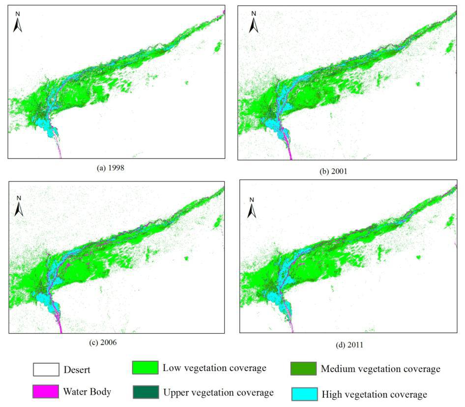
(2) Based on the long time series of Landsat remote sensing images, the project studies the inter-annual variability of vegetation coverage of Qiemo oasis and the driving mechanism, and according to multivariate data such as multi-source remote sensing images, relics census data, historical documents and archaeological data, reveals the distribution features of Qarqan River channels, and preliminarily defines the suspected region of Qiemo ancient city in the Han Dynasty.
Fig. 2 Vegetation coverage of Qiemo oasis in different years
(3) Based on multivariate data such as multi-resolution satellite imagery, census data, historical documents and archaeological data and with the 3S technology, the project uses remote sensing for archaeological survey and research on the disappeared Lucaogou ancient oasis between Guazhou and Shazhou, discovers five ancient city ruins, conducts a more detailed investigation on the formation and collects polished stoneware, ceramic fragments, brick fragments, iron fragments and one “Qidaowubai” worn coin during the Interregnum of Wang Mang (A.D. 9-25). In light of the “Duwei-Houguan-Fengsui” military organizational structure of the Han Dynasty, the project applies remote sensing to archaeological research on the military defence system along the Great Wall of the Han Dynasty. By referring to the Dunhuang Manuscripts about Geography of Shazhou in the Early Tang Dynasty (P.2005) and other historical materials, the project presents digital reconstruction of the new post road and the spatial distribution features of various courier stations between Guazhou and Shazhou after A.D. 691.

Fig. 3 Remote sensing image of new post roads and distribution of posts between Guazhou and Shazhou in A.D. 691